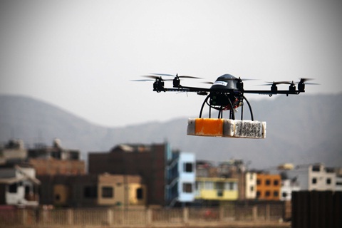
Modern day drones, or UAV’s, are most generally linked to military application. However, potato scientists in CIP are putting them to another use – a remote sensing project with sponsorship from the Bill and Melinda Gates Foundation.
Remote sensing projects make it possible for scientists to observe how plant life develops and evolves across landscapes over time through characteristics such as biomass, nutrient content, disease, and water use. In this sense, UAVs play an important role in providing scientists with images and data on plant numbers and type, the lay of agricultural land, and how crops are being affected by disease and climate change.
Currently CIP uses a number of airplane and helicopter UAVs including an impressive Oktokopter XL. This eight propellered insect-like remote flying machine was acquired from MikroKopter (Germany) and assembled in CIP and is capable of carrying up to two kilograms of camera and computer equipment and flying at altitudes of over 100m for up to 12 minutes depending on the application. The Oktokopter XL is also able to fly at a stationary position, which makes it an excellent tool for aerial photography.
The Oktokopter XL is a serious improvement over previous models. When CIP began its aerial program over 12 years ago, it used balloons mounted with cameras. The balloons were often unsafe, expensive, and time intensive. However, that all changed in 2011 when Hildo Loayza, CIP Physicist and member of the Drone team was called in to revamp the project and bring in newer technologies.
Loayza originally started working with Andres Flores from the Universidad Catolica and archaeologist Aurelio Rodriguez, both of whom had a passion for remote controlled aircraft. They were asked to develop a remote controlled aircraft capable of carrying two kilograms of camera equipment and a microcomputer. The first prototypes proved successful, and over the years CIP called in new specialists to further the project – including Susan Palacios, Luis Silva, Mario Balcázar and Gonzalo Cucho. This diverse team consisting of electrical engineers and agricultural technicians, currently spearheads the development of UAV technology for CIP, and their work developing aerial photographic and computer systems and programming for drone aircraft brings both agricultural and aerial technology together in new and exciting ways.
The remote sensing project being developed for the Bill and Melinda Gates Foundation spans across the CGIAR, with activities linked to the CGIAR Research Programs on Climate Change, Agriculture and Food Security (CCAFS) and on Water, Land and Ecosystems (WLE). It will provide new information about weather, crop performance, resource use and the improved genetic traits sought by crop breeders. In order to do so, a complete lay of the land will need to be recorded by UAVs to discern crop types, any present diseases, and the effects of climate change.
“Satellite images are not detailed enough,” says Hildo Loayza, “and UAVs with specially developed cameras are necessary in order to capture the detail and information needed by scientists for the development of a remote sensing project.”
One such specially designed camera is the Tetracam Agricultural Digital camera, which boasts a 1.2-megapixel sensor that is optimized for capturing visible light wavelengths longer than 520nm and near-infrared wavelengths up to 920nm. The CIP team is currently incorporating new programming and system technologies that allow for various agricultural cameras and small radiometers, all mounted on the same UAV, to record images and data hyperspectral from large swaths of land in an instant. Also, have the task of replacing part of the electronic control and navigation of commercial UAV by open source technologies that would reduce the costs of these vehicles.
Loayza claims that the major objective at this time is to differentiate between different potato and sweetpotato crops from high altitudes. CIP will then impose these photographs over satellite imagery and provide far great detail for use by scientists. Furthermore, the team is developing their own flight programming in order to send UAVs off on data/image missions using nothing more than installed GPS devices and satellite imagery. While monitored, the programs allow for the drones to autopilot their way through the entire operation.
The development of UAV technology at CIP is breaking new ground in the area of aerial agriculture, and its application in remote sensing projects will provide scientists with valuable information that can be used to understand local ecology at present, in order to plan for the future. “Our work is only a small part of the project,” says Loayza modestly, but that small part is proving to be a dynamic piece of the puzzle.

Bring on the drones!

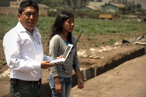
Hildo Loayza and Susan Palacios from CIP monitor the data and images being collected by a drone on a laptop during a flight. Photos: CIP
